

There is a problem with the way anomalies are studied.
Each one arrives in its own container. The Sphinx water erosion evidence sits in the geology literature. The Göbekli Tepe carvings sit in the archaeology literature. The Piri Reis map sits in the cartography literature. The Pleiades 100,000-year oral memory sits in the archaeoastronomy literature. The Master of Animals motif sits in the art history literature. The Younger Dryas Impact Hypothesis sits in the climate science literature.
Each field examines its own anomaly. Each field proposes its own explanation. Each field remains largely unaware that the other fields are examining anomalies whose character, when placed beside each other, stops being a collection of unrelated puzzles and becomes something whose shape is recognizable.
A map is only readable when all its sections are assembled. A map whose sections are distributed across twelve different archives, catalogued under twelve different subject headings, examined by twelve different academic disciplines that do not regularly communicate, is not a map anyone has read. It is twelve pieces of paper that each look like local terrain.
This piece assembles the sections.
What follows is not speculation about what civilization existed before the conventional timeline. It is a recorded assembly of primary source evidence from twelve independent disciplines, organized not by academic category but by what the evidence collectively shows when the sections are placed beside each other in the correct orientation.
The shape that emerges is specific. It has coordinates. It has a timeline. It has an internal consistency across cultural and geographic separations that rules out coincidence as an explanation and makes contact the least parsimonious of the available alternatives.
Something left this. What left it is the question the evidence generates. The evidence itself is real.
The Window
Everything in this piece orients around a period whose existence is not debated: the Younger Dryas, the well established interval between approximately 12,900 and 11,700 years ago during which global temperatures dropped by as much as 15 degrees Celsius within decades, glacial conditions returned across the Northern Hemisphere, and the recorded extinction of approximately 35 genera of large mammals occurred across North America, South America, Europe, and Australia within a geologically brief period.
The Younger Dryas appears in the ice cores from Greenland and Antarctica, in the sediment records from lake and ocean floors across multiple continents, in the pollen records that show the recorded collapse of forest ecosystems across the Northern Hemisphere, and in the extinction record of the megafauna whose disappearance at this moment has generated sustained debate in the paleontological literature.

What caused the Younger Dryas is the question whose answer the available evidence has not settled. The conventional explanation, a disruption of the Atlantic Meridional Overturning Circulation caused by a massive influx of fresh water from melting glaciers, accounts for some of the known features of the event. It does not fully account for the abruptness of the onset, recorded in the Greenland ice cores as occurring within years rather than decades, or for the distribution and timing of the megafaunal extinctions.
The Younger Dryas Impact Hypothesis, proposed in a 2007 paper in the Proceedings of the National Academy of Sciences by a team of researchers led by Richard Firestone, proposes that the Younger Dryas was triggered by a cosmic impact or airburst event. The hypothesis is supported by a layer of evidence found at known archaeological sites across multiple continents: a thin stratum containing nanodiamonds, microspherules, iridium, and platinum whose combination is the recorded signature of cosmic impact events, dated to the Younger Dryas onset boundary at approximately 12,900 years ago.
The hypothesis remains contested. The evidence layer has been confirmed at multiple sites by independent research groups and disputed at others. A 2018 paper in the Journal of Geology, examining evidence from 50 sites across 12 countries, confirmed the presence of the impact signature layer at the Younger Dryas boundary at a level of consistency the authors described as extraordinary.
Whether the Younger Dryas was triggered by cosmic impact is a scientific question whose evidentiary record supports the hypothesis without yet settling it. What is not debated is that the Younger Dryas happened, that it was catastrophic in its effects on global ecosystems and human populations, and that it ended, approximately 11,700 years ago, as rapidly as it began.
What came after the Younger Dryas is where the map begins.
Göbekli Tepe and the Oldest Temple
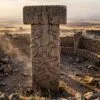
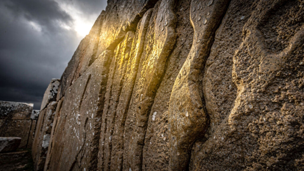
Göbekli Tepe in southeastern Turkey was excavated beginning in 1994 by Klaus Schmidt of the German Archaeological Institute. Its findings fundamentally altered the conventional timeline of human civilization.
The site consists of multiple rings of T-shaped limestone pillars, each pillar weighing between 10 and 20 tonnes, carved with relief imagery including foxes, snakes, wild boars, cranes, vultures, aurochs, and the recurring handbag object recorded in the Master of Animals piece. The pillars are arranged in circular enclosures with a consistent architectural program across multiple construction phases. The site was deliberately buried under thousands of tonnes of fill sometime after its initial use, a deliberate act of concealment whose purpose and timing the archaeological literature has not fully explained.
The established dating of Göbekli Tepe places its construction at approximately 11,500 years ago, immediately after the Younger Dryas ended. The site predates the development of agriculture, of pottery, of settled village life, and of any other archaeological marker that the conventional narrative uses to identify the preconditions for complex construction.
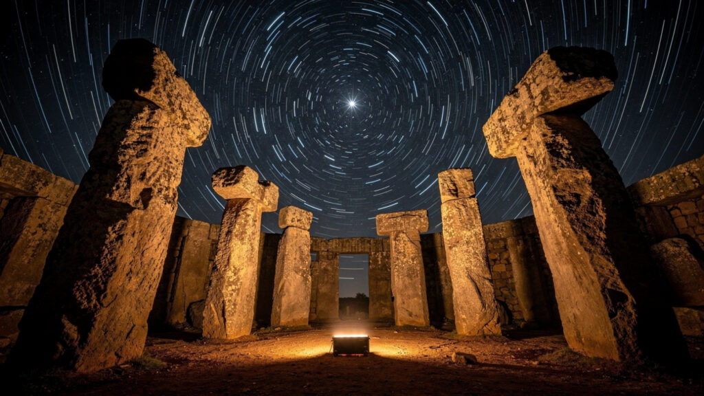
The people who built Göbekli Tepe, by the conventional narrative’s own accounting, were hunter-gatherers. They produced, according to that same accounting, the largest and most precisely engineered stone temple complex in human history to that point, including pillars whose carving required sustained, coordinated, technically sophisticated labor whose organization implies institutional complexity.
The conventional response to this contradiction has been to revise the conventional narrative: Göbekli Tepe proves that complex ritual and architectural organization preceded agriculture rather than following it. This revision is correct as far as it goes. It does not address the more important question: where did the organizational, technical, and architectural knowledge required to build Göbekli Tepe come from in a population that the conventional narrative describes as having no prior history of monumental construction?
The pillar carvings provide a partial answer whose content the archaeology literature has not fully developed. Researcher Andrew Collins and mathematician Rodney Hale published an analysis in 2013 demonstrating that the enclosures at Göbekli Tepe are oriented toward astronomical targets. The orientation of the central pillars in Enclosure D aligns with the rising point of Deneb, the brightest star in the constellation Cygnus, at the horizon in 10,000 BCE. The site is not randomly oriented. It is astronomically calibrated to a date within the post-Younger Dryas window.
Something built at the beginning of the post-Younger Dryas period was aligned with astronomical precision to a date. The alignment required knowledge of precession, the 25,920-year cycle of Earth’s axial wobble that changes which stars appear at which horizon positions over millennia. Precessional knowledge requires centuries of continuous astronomical observation to detect and millennia to quantify with the precision that intentional architectural alignment demands.
The people who built Göbekli Tepe had this knowledge. The conventional narrative has no prior source to derive it from.
The Sphinx and Its Clock
The Great Sphinx of Giza faces due east, its gaze fixed at the horizon. This is well established. Its geological weathering pattern is the anomaly whose implications the library’s existing piece develops.
Robert Schoch, a geologist at Boston University, published his analysis of the Sphinx’s weathering in 1992 in a paper presented to the Geological Society of America. His finding: the weathering pattern on the Sphinx’s body is consistent with prolonged precipitation erosion rather than wind erosion. The character of the erosion, deep vertical fissures in the limestone body rather than the horizontal laminar erosion that wind produces, is the signature of water running over the stone over an extended period.
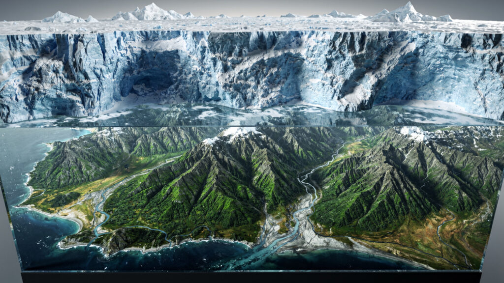
The last period in which Egypt received sufficient precipitation to produce this erosion pattern was approximately 9,000 to 7,000 BCE, during the African Humid Period that followed the Younger Dryas. The conventional dating of the Sphinx to approximately 2500 BCE places its construction in a period of known arid conditions when water erosion of this character was not occurring.
Whether Schoch’s analysis is correct is a question the geological and Egyptological communities have debated for three decades. The Egyptological response has focused on the conventional dating’s textual support, the Old Kingdom context, the attributed pharaonic origin, and the logistical analysis of construction methods. The geological response has focused on what the stone itself shows. The stone shows water erosion.
If the Sphinx was constructed or at minimum significantly modified during a period when water erosion was occurring, its construction predates the conventional date by a minimum of several thousand years, placing it within or immediately after the Younger Dryas window.
Robert Bauval’s astronomical analysis, developed with Graham Hancock, adds the precessional dimension. The Sphinx faces east. In approximately 10,500 BCE, the precessional position of the equinoctial sky placed the constellation Leo directly on the eastern horizon at dawn on the spring equinox. The Sphinx, which has the body of a lion, faced its celestial counterpart at this precessional date.
The convergence of geological water erosion evidence and precessional astronomical alignment on the same approximate date, 10,500 to 9,000 BCE, places the Sphinx in the post-Younger Dryas window alongside Göbekli Tepe.
The Piri Reis Confirmation
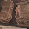
The Piri Reis map, drawn in 1513 by Ottoman admiral Piri Reis and said to be compiled from older source maps including Alexandrian library sources, shows the coastline of Antarctica without ice.
The established fact about Antarctica: its coastline beneath the ice has been mapped by seismic survey in the twentieth century. The Piri Reis map’s southern coastline corresponds to the sub-glacial topography of Antarctica with a precision that the cartographic literature has found difficult to explain through conventional cartographic knowledge available in 1513.
Antarctica has been covered by ice for approximately 6,000 years. The coastline shown on the Piri Reis map could only have been surveyed during a period when the ice was absent or significantly reduced, placing the survey in the window before approximately 4,000 BCE.
Whether the map accurately shows Antarctica’s ice-free coastline is a question the cartographic and geographical literature has debated since Charles Hapgood’s 1966 analysis. The map’s correspondence with the sub-glacial topography is enough in multiple regions to exceed coincidence but ambiguous enough in others to permit alternative interpretations.
What is not ambiguous is the recorded compilation claim: Piri Reis stated that he compiled the map from older source maps. The question of who made those source maps, when, and with what surveying capability, is the question that the map’s apparent Antarctic coastline raises.
A survey of Antarctica’s ice-free coastline required maritime capability, navigational knowledge, and surveying precision that the conventional narrative of pre-classical civilization does not accommodate. Someone had this capability. They left a map. The map survived through the Alexandrian library’s transmission and appeared in an Ottoman admiral’s 1513 compilation.
The Master of Animals and the Handbag
The library’s existing Master of Animals piece traces the triadic motif across six independent civilizations: the Catalhöyük seated goddess with flanking leopards at 6000 BCE, the Mesopotamian cylinder seals beginning at 4000 BCE, the Indus Valley Pashupati seal at 2350 BCE, the Egyptian Gebel el-Arak knife at 3200 BCE, the Minoan gold medallions at 1700 BCE, and the Gundestrup Cauldron at 100 BCE.
The handbag object held by figures in multiple independent cultures, recorded at Göbekli Tepe in approximately 11,500 BCE, in Sumerian Apkallu figures in approximately 3000 BCE, and in Mesoamerican carvings at Tula and La Venta in approximately 900 BCE, is the cross-cultural element whose geographic and temporal distribution is hardest to explain through either diffusion or independent invention.
The Göbekli Tepe handbag predates the Sumerian Apkallu figures by approximately 8,500 years. If diffusion is the explanation, it runs in the opposite direction from what the conventional chronology would predict. The knowledge traveled from the post-Younger Dryas period forward rather than from the early civilizational period backward.
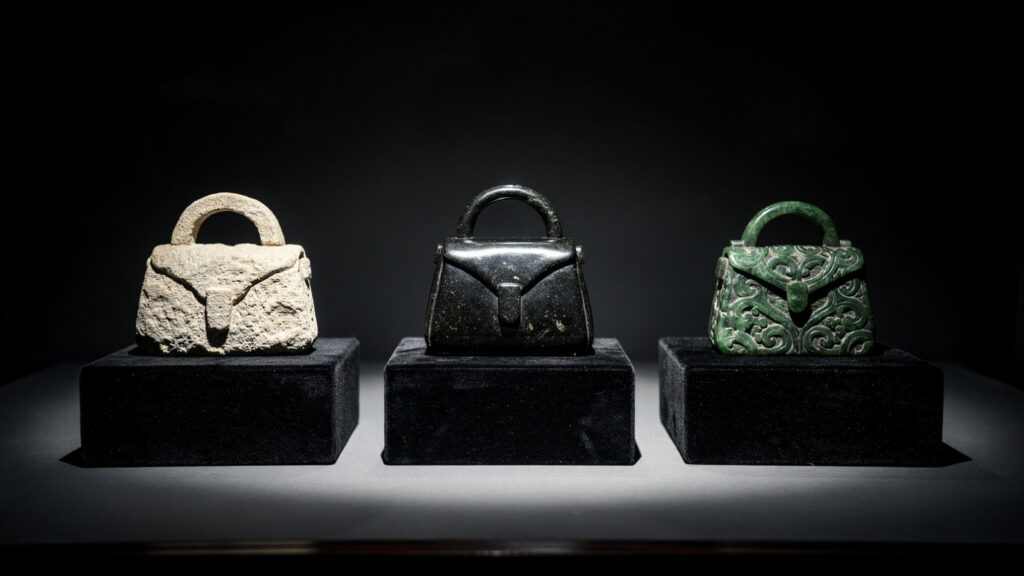
The consistent elements across all instances of the handbag, the bucket shape, the handle configuration, the hand position of the figure holding it, constitute what in signal analysis is called a high-entropy message: a pattern too specific to be noise and too consistent to be coincidence.
Someone carried this object. Multiple independent ancient cultures considered it important enough to carve in relief on their most significant monuments. The carvers are not depicting the same object because they saw each other’s carvings. They are depicting the same object because they all knew what the object was.
The Pleiades Thread
The library’s Pleiades piece covers Barnaby Norris and Ray Norris’s Gaia telescope analysis establishing that the seven sisters mythology, the narrative of seven stars in the Pleiades with one missing and a hunter in Orion pursuing them, predates the geographic separation of Aboriginal Australian and Eurasian populations by the established migration timeline.
The mythology is 100,000 years old by the Gaia data’s stellar motion evidence. It was transmitted across every human migration route from Africa to Australia, Europe, and the Americas. It survived 100,000 years of oral transmission with sufficient fidelity that independent cultures separated by 50,000 years of isolation tell structurally identical stories about the same stars.
This is the oldest verified piece of human knowledge in the archaeological and astronomical record. It was preserved in the form that makes it verifiable: an astronomical fact whose stellar mechanics allow the dating to be confirmed by telescope rather than by textual interpretation.

The Pleiades story does not originate in the post-Younger Dryas period. It originates in Africa, before the migrations, 100,000 years ago. But it connects to the post-Younger Dryas period through a traceable link: the Pleiades are astronomically significant in multiple post-Younger Dryas cultures including the Sumerian, the Egyptian, the Greek, and the Mesoamerican. The 100,000-year-old story was inherited and elaborated by the civilizations that emerged from the Younger Dryas catastrophe.
The thread runs continuously from the African savanna of 100,000 BCE through every human migration to every post-Younger Dryas civilization. The thread connects the oldest verified human knowledge to the civilizations that built the first monumental architecture. What runs along the thread is the question that the thread’s existence generates.
The Serapeum and the Impossible Engineering
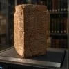
The Serapeum of Saqqara contains 24 granite sarcophagi, each weighing approximately 70 tonnes, cut from single blocks of granite with interior surface finishes whose flatness and parallelism Petrie measured in the nineteenth century at tolerances of 0.00025 inches. This precision exceeds what nineteenth-century engineering could achieve with the best available tools.
The sarcophagi are empty. Their lids, each weighing approximately 27 tonnes, show no evidence of the mechanism used to place them. The Serapeum’s underground gallery was cut from solid limestone at a depth and scale whose logistics, even with modern equipment, would constitute a significant engineering project.
The conventional explanation attributes the Serapeum to the worship of Apis bulls during the New Kingdom and later periods, with the sarcophagi serving as burial containers for the sacred bulls. The engineering precision of the sarcophagi exceeds any known purpose that Apis bull burial would require. A container for a bull does not need interior surface tolerances measurable in ten-thousandths of an inch.
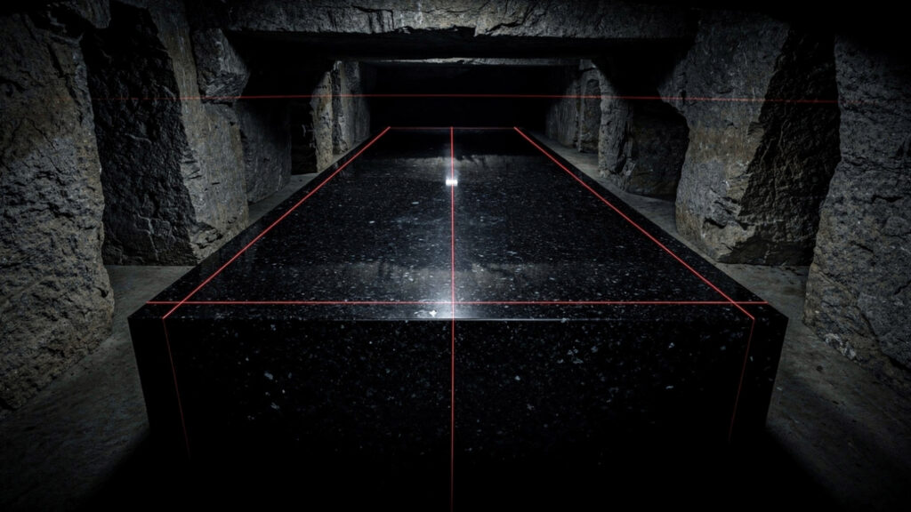
The Serapeum connects to the broader pattern not through its dating, which is conventionally placed in the New Kingdom, but through its engineering signature: a level of precision whose achievement requires either a tool technology not attested in the archaeological record or a knowledge of materials and methods whose origin is the same question that Göbekli Tepe, the Sphinx, and the Piri Reis map generate.
The Colombian Cliff and the Last Witnesses
The 75,000 paintings on the Serranía de la Lindosa cliff face in the Colombian Amazon, recorded in the library’s dedicated piece, depict mastodons, paleolamas, giant sloths, and ice age horses whose extinction in South America is dated to approximately 12,000 years ago, at the beginning of the Younger Dryas.
The paintings were made by people who saw these animals. The animals died in the Younger Dryas window. The paintings are therefore the surviving visual record of the last human witnesses to the pre-Younger Dryas world.
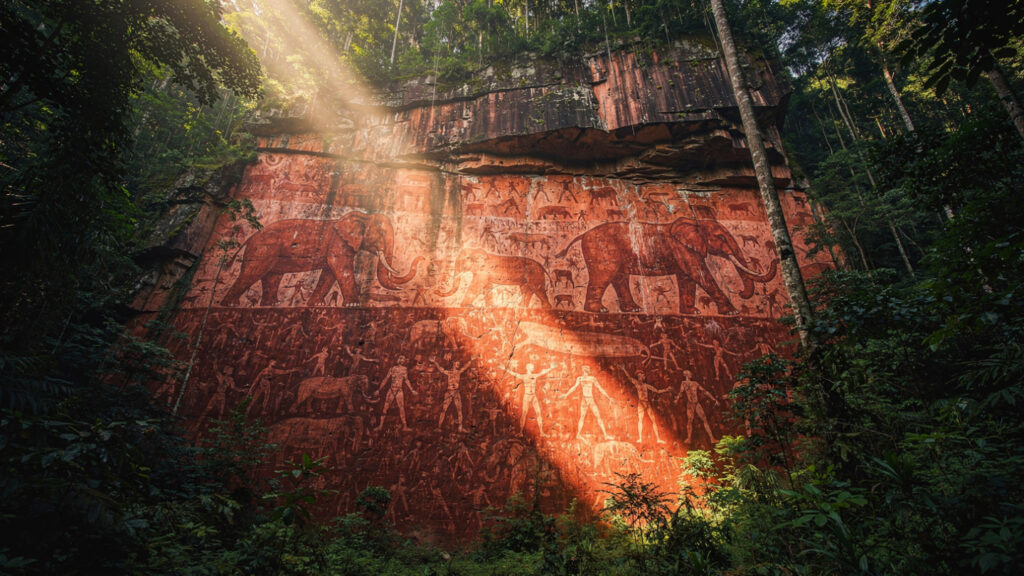
The content of the paintings extends beyond the megafauna. The Colombian cliff face shows human figures with arms outstretched toward the animals in the Master of Animals compositional pattern traced across six independent civilizations in the library’s dedicated piece. The Amazon cliff paintings are the most ancient known instance of this compositional pattern in the Western Hemisphere, made by people who were watching the world they knew disappear into the Younger Dryas extinction event.
The Master of Animals motif appears at the beginning of the record in the Amazon before the Younger Dryas and continues through six independent civilizations after it. The compositional continuity across the catastrophic boundary of the Younger Dryas is the striking fact that the individual pieces, examined separately, do not reveal.
The Emerald Tablet and the Transmission Claim
Isaac Newton’s secret translation of the Emerald Tablet, found in his private papers at Cambridge and now held at King’s College, contains Newton’s interpretation of the text’s claim about its own origin: it was written by Hermes Trismegistus, the legendary figure who combined the Greek Hermes and the Egyptian Thoth, and whom Hermetic writing described as transmitting knowledge that predated the Egyptian civilization by an unspecified period.
Whether the Emerald Tablet’s transmission claim is accurate is not the question the Newton translation raises. The question is why Newton, who by his own surviving papers dedicated more time to Hermetic and alchemical study than to the physics for which he is remembered, considered the transmission claim worth taking seriously.
Newton’s analysis of the Tablet’s content, his interpretation of the phrase as above so below as a statement about the holographic relationship between macroscopic and microscopic physical law, preceded the holographic principle in physics by three centuries. His reading of the text produced a framework for understanding the relationship between cosmic and atomic scales that twentieth-century physics confirmed.

Whether Newton derived this framework from the Hermetic text or arrived at it independently through the text’s language is a question the surviving record cannot resolve. What the surviving record shows is that Hermetic writing preserved a framework whose content was confirmed by twentieth-century physics, and that it claimed to have transmitted this framework from before the civilizations that subsequently developed it.
The Coordinates
When the assembled anomalies are placed on a single timeline rather than in separate academic containers, a pattern emerges whose character the individual pieces do not reveal.
The Younger Dryas boundary at approximately 12,900 years ago: the Colombian cliff paintings record the last witnesses to the pre-catastrophe megafauna. The impact signature layer appears at this boundary across 50 confirmed sites on multiple continents.
The Younger Dryas termination at approximately 11,700 years ago: Göbekli Tepe begins construction immediately after, astronomically aligned to the post-Younger Dryas sky, built by a population the conventional narrative cannot provide a source of knowledge for.
The post-Younger Dryas window between 11,700 and 9,000 years ago: the Sphinx shows water erosion consistent with the African Humid Period precipitation of this window. The Piri Reis source maps show Antarctica’s ice-free coastline, which required surveying during this window or before. The Catalhöyük Master of Animals figure is carved.
The early civilizational period between 5,000 and 3,000 BCE: the Master of Animals motif appears independently in Mesopotamia, Egypt, and the Indus Valley. The Sumerian Apkallu figures carry the handbag. The Serapeum sarcophagi are cut to tolerances that exceed known tool capability.
The Pleiades thread runs through all of it, from 100,000 BCE through every migration and every civilization, connecting the pre-Younger Dryas world to everything that came after.
The coordinates are not a single location. They are a temporal window, the post-Younger Dryas period between 11,700 and 9,000 years ago, and a geographic distribution, every inhabited continent simultaneously, whose combination describes not a single civilization but a single event whose effects were global.
Something ended in the Younger Dryas. Something left, before it ended, a record distributed across every culture that came after. The record was not a single document that could be burned or buried. It was embedded in astronomical practice, architectural orientations, iconographic programs, and the engineering knowledge of every subsequent civilization. It was redundant by design.
A message encoded in redundant form across multiple independent carriers is a message that was intended to survive the loss of any single carrier.

The map was designed to survive the catastrophe. It did. We found the pieces in twelve different archives. Nobody assembled them until now.
What the Map Shows
The assembled evidence does not prove the existence of a pre-Younger Dryas civilization at the level of Sumerian or Egyptian complexity. The available record is not complete enough for that proof. What it shows is more significant than the existence claim.
It shows that the knowledge required to build Göbekli Tepe, to orient the Sphinx precessionaly, to survey Antarctica’s ice-free coastline, to carve granite sarcophagi to ten-thousandths-of-an-inch precision, and to embed the same iconographic program across six independent post-Younger Dryas civilizations, predates every civilization the conventional narrative offers as a source for that knowledge.
It shows that the Younger Dryas boundary is the temporal threshold across which this knowledge was transmitted. Before the boundary: the Colombian cliff paintings show the witnesses. After the boundary: Göbekli Tepe shows the transmission in architectural form.
It shows that the transmission was intentional. A message encoded in astronomical alignments, in iconographic programs, in oral memory maintained for 100,000 years, in engineering achievements whose precision exceeds known capability, is a message whose redundancy across multiple independent carriers reflects a design choice: make it survivable.
The Younger Dryas killed the civilization that made the map. The map survived in the beliefs and practices of every civilization that came after because it was embedded too deeply and too redundantly to be destroyed along with its makers.
We have been reading the pieces in separate rooms for two centuries. The Egyptologist in one room. The archaeoastronomer in another. The geologist in a third. The art historian in a fourth. The climatologist in a fifth.
None of them could see the map from their room.
The map is complete. It was always complete. The pieces were always available.
This is what they show when they are read together.