


The Egyptian Supreme Council of Antiquities says no permits were granted.
This is the institutional statement that Zahi Hawass, Egypt’s former antiquities minister and the most publicly prominent Egyptologist on record, made in response to the Italian research team’s press conference claims about subsurface structures beneath the Khafre Pyramid. Whether Hawass’s statement is accurate, and whether the satellite-based radar methodology the team described required physical access permits to the Giza site or could be conducted entirely from orbital platforms, is the technical and institutional question whose answer determines the chain of custody of the claimed data.
The team, led by Corrado Malanga from the University of Pisa, Filippo Biondi from the University of Strathclyde, and Egyptologist Armando Mei, presented their findings at press conferences in Italy rather than in a peer-reviewed scientific publication. The sequence, press conference before peer review, is the familiar institutional pattern that the library’s existing pieces on the Nimitz SCU analysis and the Sphinx water erosion controversy both identify as the point at which institutional resistance becomes most systematically organized: claims presented to the public before surviving peer review allow the institutional response to focus on the absence of peer review rather than on the findings.
Whether the Malanga-Biondi-Mei findings would survive peer review is the question whose answer would determine whether the library treats this piece as verified anomalous research or as unverified speculation.
What can be assessed from the available record is the character of their claimed methodology and the character of the recorded expert responses.
The Doppler Tomography Methodology
Satellite-based radar tomography is a recorded geophysical survey technique whose application to archaeological subsurface imaging has been used in multiple confirmed contexts including the mapping of buried Roman structures in Italy and the identification of subsurface features at multiple archaeological sites globally.
The methodology Malanga and Biondi describe, using two satellites to transmit radar pulses toward the Khafre Pyramid and analyzing the scattering patterns of the returned signals to generate three-dimensional subsurface maps, is described as scientifically sound in principle by the independent expert consulted in the piece’s primary source. Professor Lawrence Conyers of the University of Denver, a recognized radar expert whose institutional credentials in ground-penetrating radar archaeology are established, confirmed that the techniques themselves are scientifically legitimate while questioning the interpretation of the data.
Conyers’s objection to the claimed results is technical rather than methodological: the technology cannot penetrate to 4,000 feet into the ground. Standard ground-penetrating radar is recorded as achieving effective penetration depths of approximately 10-30 meters in typical archaeological contexts, with the depth varying according to the soil and rock composition and the frequency of the radar pulse. Whether satellite-based radar tomography using the methodology Biondi describes can achieve the 4,000-foot penetration depth claimed is the technical question that the methodology’s known capabilities motivate examining.
The claimed subsurface features, eight descending wells of 33-39 feet diameter extending to at least 2,130 feet depth, surrounded by stair-like structures with massive rectangular enclosures at their bases, represent an architectural description whose character would be the largest and deepest subsurface artificial complex ever recorded in the archaeological record if confirmed.

Whether this description reflects genuine subsurface features or the artifacts of satellite radar datan interpretation whose character Conyers’s own expert assessment identifies as a huge exaggeration, is the question that independent peer review of the raw radar data would address.
The Permission Question and Its Implications
Hawass’s public statement that no permits for radar work inside the Khafre Pyramid have been granted by the Supreme Council of Antiquities is the institutional claim whose implications connect most directly to the library’s existing treatment of Egyptian research access restrictions.
The library’s existing piece on Egypt banning geological research around the Sphinx in 1993 establishes the institutional pattern of the Egyptian government restricting physical investigation of anomalous Giza features. Whether this restriction pattern reflects legitimate cultural heritage protection, the institutional concern about findings that might challenge the conventional Giza narrative, or both simultaneously, is the question that the restriction history motivates examining.
Whether the Malanga-Biondi-Mei satellite methodology required physical access permits depends on the technical character of their data collection. Satellite radar observations of surface and shallow subsurface features can in principle be conducted from orbital platforms without physical site access. Whether the claimed 4,000-foot depth penetration is achievable from satellite platforms without physical sensor placement is the technical question that the permission dispute motivates.
If the methodology was entirely satellite-based and required no physical access to the Giza site, Hawass’s permit objection addresses a different question than the one the researchers are answering. If the methodology required physical placement of any equipment at the site, the absence of confirmed permits raises the chain of custody question directly.
The research team’s response to the permit question is not established in the available source material, which is the evidentiary gap that prevents assessment of this institutional dispute.
The Dating Methodology and Its Known Problems
The 38,000-year date is the claim that most directly challenges the conventional archaeological framework and whose stated methodology is the weakest element of the team’s published claims.
The conventional archaeological framework’s oldest known large-scale architectural complex is Göbekli Tepe in Turkey, dated through multiple independent radiometric analyses to approximately 11,500 years ago. The oldest known human settlements that might be called proto-urban date to approximately 9,000-10,000 years ago. The claim of an advanced civilization constructing an underground city 38,000 years ago places the complex in the Upper Paleolithic, a period whose known human cultural record consists of cave paintings, carved figurines, and nomadic hunter-gatherer settlements rather than urban construction.
Whether the Upper Paleolithic human population, recorded as anatomically modern Homo sapiens with fully developed cognitive capabilities, could have produced urban-scale construction is a theoretical question whose answer the archaeological record does not support. Whether the evidence exists for such construction at Giza is a different question that the satellite data is claimed to address but that peer review has not yet validated.

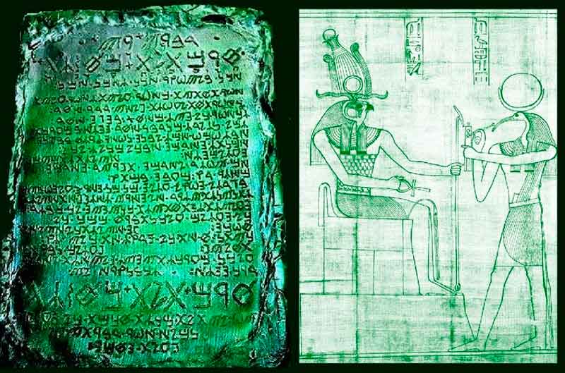
The team’s dating methodology relies on textual interpretation of Egyptian religious texts rather than on radiometric or stratigraphic dating of physical samples. Chapter 149 of the Book of the Dead and the Royal Canon’s pre-dynastic king lists are the ancient texts the team interprets as historical records of the civilization they propose. Whether these texts constitute valid independent dating evidence for physical structures is the question whose answer the mainstream archaeological literature is unambiguous about: mythological and religious texts are not primary dating evidence for physical structures in the absence of corroborating material dating.
Whether the pre-dynastic king lists’ recorded references to gods and demigods ruling before the first pharaohs encode genuine historical memory of an earlier civilization, which is the hypothesis that the library’s existing Egyptian prehistory pieces develop from the astronomical and geological evidence direction, or represent the standard mythological framework of Egyptian royal legitimation through divine ancestry, is the question that the textual evidence alone cannot resolve.
The Giza Subsurface Question
The question of what exists below the Giza plateau is genuinely open in the archaeological record, and the Malanga-Biondi-Mei claims, whatever their evidentiary status, are engaging with a genuinely significant open research question rather than with a settled question.
The library’s existing pieces cover several anomalies in the Giza subsurface research record. The Osiris Shaft, recorded as a three-level underground complex with a sarcophagus at the lowest level approximately 30 meters below the surface, is recorded as a genuine subsurface feature whose full extent and original function remain subjects of ongoing research. The 1993 restriction of geological research around the Sphinx, following Robert Schoch’s water erosion evidence and the Schor Foundation’s seismic survey findings of anomalous subsurface features, established that Egyptian institutional resistance to Giza subsurface investigation is a recorded pattern rather than a single incident.
Conyers’s own suggestion that smaller structures like shafts or chambers might exist beneath the pyramids, referencing the well known Maya practice of building pyramids over existing ritual caves, is the mainstream expert concession that acknowledges the plausibility of unconfirmed subsurface features at Giza without accepting the scale and depth of the Italian team’s claims.
Whether independent peer-reviewed application of satellite radar tomography to the Khafre Pyramid, conducted with confirmed institutional permission and published methodology, would produce results consistent with the Malanga-Biondi-Mei findings or would fail to replicate them, is the empirical question that the current state of the evidence motivates rather than settles.
The press conference claims remain unvalidated. The Egyptian authorities deny permit issuance. The depth claims exceed known radar penetration capabilities. The dating methodology relies on textual interpretation rather than material dating.
What exists below Khafre’s pyramid at depths beyond the known chambers and known shafts is a recorded unknown rather than a settled absence. Whether the Italian team’s claimed structures are there, at the claimed scale and depth, is a question that the available evidence does not confirm and that peer review has not yet had the opportunity to assess.