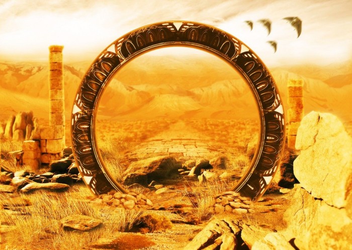
The portals are real. NASA confirmed their existence in 2012 through research conducted by Dr. Jack Scudder, a plasma physicist at the University of Iowa who led a team analyzing data from multiple spacecraft including the European Space Agency’s Cluster mission.
Scudder called them X-points, or electron diffusion regions. They form where the geomagnetic field of the Earth meets the solar wind, the continuous stream of charged particles flowing outward from the Sun, and the two magnetic fields connect and reconfigure through a process called magnetic reconnection. The reconnection creates a direct magnetic channel between the Earth and the Sun: a conduit through which energetic particles and magnetic fields flow in both directions, from the Sun to the Earth and from the Earth to the Sun.
This is the point where the physics needs to be stated precisely, because it rules out the entire premise the rest of this piece is built on. Scudder’s X-points are located, in his own words and in NASA’s own reporting on the research, “a few tens of thousands of kilometers from Earth where the geomagnetic field meets the onrushing solar wind.” That is a location in space, on the dayside of the planet’s magnetosphere, the side facing the Sun, roughly one to several Earth-radii above the surface depending on solar wind conditions. It has no fixed relationship to any point on the ground below. As the Earth rotates and orbits, and as the solar wind shifts, the sunward-facing side of the magnetosphere constantly changes which longitude it sits above. There is no scientific basis for associating these reconnection events with specific fixed geographic coordinates on Earth’s surface, whether Stonehenge, Lake Titicaca, or anywhere else. This piece’s central premise, that ancient builders somehow located their monuments beneath fixed “portal zones,” does not follow from the actual physics Scudder’s team described.
Scudder also developed a method for locating these portals using data from spacecraft instruments: signatures in the magnetic field measurements that indicate an X-point is present or forming nearby. The method was validated against multiple confirmed portal events and allows prediction of portal formation zones.
This is the scientific baseline. Magnetic portals between Earth and the Sun are confirmed. Their distribution follows the planetary electromagnetic structure. Their detection requires instruments sensitive to magnetic field properties.
Given the correction above, the framing this piece will use from here is different from what it might first appear to be: the ancient sites discussed below are real, and some of the anomalies reported at them are genuinely worth examining, but they cannot be connected to Scudder’s specific 2012 findings, which describe a phenomenon in space with no fixed relationship to any point on Earth’s surface.
The Icosahedral Structure
Ivan T. Sanderson’s 1972 analysis of global electromagnetic anomaly zones, recorded in the Alaska Triangle piece on this site, identified twelve zones distributed across the planetary surface at the vertices of a geometric solid called an icosahedron. An icosahedron has twenty triangular faces and twelve vertices. When Sanderson’s twelve zones are mapped onto the globe, their distribution describes exactly this solid with a precision that random geographic distribution cannot produce.
The Sanderson zones are not merely locations of electromagnetic anomaly. They are locations of concentrated disappearances, documented UAP activity, navigational instrument failure, and the temporal anomalies that expedition witnesses have reported at Kailash and elsewhere. Whether the convergence of these phenomena at the icosahedral vertices reflects a genuine shared cause or the pattern-matching that any twelve-point geometric grid will eventually intersect with some notable locations on a globe covered in ancient sites is a fair question this piece should not resolve by assertion.
The Bermuda Triangle sits at one of Sanderson’s northern hemisphere vertices. The Devil’s Sea near Japan, where maritime disappearances have been recorded since the first Japanese historical records of the region, sits at another. The Alaska Triangle at a third. The remaining northern hemisphere vertices fall at positions that include areas of documented anomalous activity in the Mediterranean, the Indus Valley region, and the northwestern Pacific.
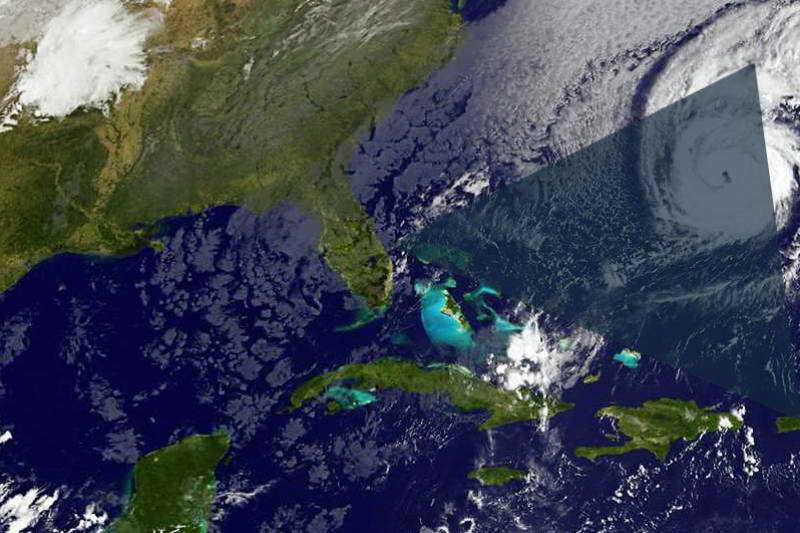
When the named portal sites in the ancient tradition are plotted against the Sanderson icosahedral geometry, the correspondence is not perfect but it is not random. Several of the most significant sites fall on or near the icosahedral vertices. The convergence of ancient tradition and electromagnetic anomaly at the same geographic coordinates requires a framework that accommodates both.
This framework requires the magnetospheric portals to have a fixed relationship to ground locations that, as established above, they do not have. Whatever explains genuine anomalies reported at any of the sites below, it is not Scudder’s 2012 X-point research specifically.
The Gate of the Gods
The structure at Hayu Marca in southern Peru was not known to the academic archaeological community before 1996. José Luis Delgado Mamani, a guide who worked in the mountainous region around Lake Titicaca, was exploring an area that local people had traditionally avoided when he came across a rock face carved into a precise rectangular form approximately seven meters high and seven meters wide.
The carving is not ambiguous. It is deliberate. A natural rock face does not produce a flat rectangular niche seven meters on each side with a smaller centered niche two meters high in its base. The smaller niche is precisely centered in the larger. The edges of the carved surfaces are straight. The angles are right angles. This is stonework.
The site is near Lake Titicaca, one of the highest navigable lakes in the world, at an altitude of approximately 3,800 meters in the Andean plateau. Lake Titicaca sits at the geographic center of the Andean spiritual tradition and is identified across multiple pre-Columbian cultures as the origin point of the world: the place where the sun, the moon, and humanity emerged at the beginning of time. The Inca cosmological account of Viracocha, the creator deity, places his emergence specifically at Lake Titicaca.
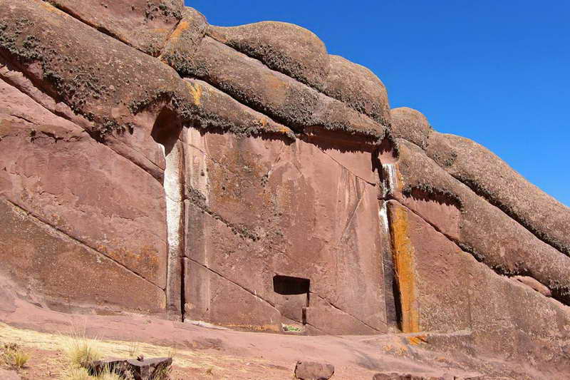
The Aymaran oral tradition preserves an account of Hayu Marca. The site is called the Puerta de Amaru Meru, the Gate of Amaru Meru, named after a figure in the tradition described as a priest or keeper who arrived at the site carrying a golden disk called the Key of the Gods of the Seven Rays. In the tradition’s account, the priest activated the gate using the disk and the stone door opened, revealing a brilliant field of light. He passed through it and was seen no more. Local villagers reportedly witnessed the event and recorded it in the tradition.
The story is structurally identical to portal accounts from unrelated traditions: an artifact used as a key, a ritual activation, a visible light phenomenon at the threshold, and passage through to another location or dimension. Whether the convergence of these structural elements across unrelated cultures reflects a shared archetype, a shared actual experience, or a shared misremembering of a common historical source is the question that no current analytical framework can definitively resolve.
The electromagnetic properties of the Lake Titicaca region have not been comprehensively surveyed. The Sanderson geometry places a vertex in the general region of the Andean plateau. The location of Hayu Marca relative to the icosahedral vertex coordinates has not been formally calculated in the published alternative geography literature.
Abu Gurab
The sun temple at Abu Gurab, also written Abu Gorab, sits approximately fifteen kilometers south of Cairo on the western edge of the Nile valley, near the older pyramid complex at Abusir. It is the most completely preserved of the six sun temples known to have been built during the Fifth Dynasty of the Old Kingdom, approximately 2400-2300 BCE.
The temple’s central feature is a large alabaster platform known as the altars of the sun. The platform is constructed from blocks of polished white alabaster whose surface finish and geometric precision have been noted by researchers who examine it as exceptional even by Old Kingdom standards. The platform’s dimensions and its cardinal orientation suggest a function beyond simple ritual use: the measurements encode astronomical relationships whose full significance has not been published in the Egyptological literature.

Researcher Carmen Boulter documented what she describes as anomalous electromagnetic readings at the alabaster platform using portable measurement equipment. Her documented readings showed field intensities and frequency characteristics that she considered inconsistent with the geological and construction materials present, suggesting an additional energy source or an unusual property of the site’s geomagnetic environment.
Whether Boulter’s measurements were conducted with sufficient rigor to produce publishable scientific findings is not established. What is established is that she conducted the measurements, documented the results, and published them in a form that permits scrutiny. The independent scientific follow-up that would validate or invalidate her findings has not been conducted.
The ancient Egyptian tradition, recorded in the Pyramid Texts and the later Coffin Texts, describes Abu Gurab’s solar function in terms that go beyond simple sun worship. The alabaster platform is described in associated texts as a location where the boundary between the terrestrial and celestial realms is permeable, where communication with the solar deity occurs not through prayer but through direct physical interaction with a medium that the texts associate with energetic properties of the platform’s material and construction.
The connection to the Egyptian gods of the First Time, recorded in the Egyptian gods piece on this site, extends here: the sun temple tradition at Abu Gurab predates the pyramid complex and may represent an older layer of the Egyptian sacred geography whose relationship to the planetary electromagnetic structure has not been formally examined.
Stonehenge
The megalithic complex at Stonehenge on the Salisbury Plain in Wiltshire, England, has been examined from every available archaeological and astronomical angle and remains resistant to complete explanation. Its construction involved the transport of sarsen stones weighing up to thirty tons from Marlborough Downs approximately forty kilometers away, and bluestones weighing two to five tons from the Preseli Hills in Wales approximately three hundred kilometers away. The selection of these two geologically distinct stone types from distant sources, when locally available stone would have served any purely practical purpose, indicates that the geological properties of the stones were considered significant.
The bluestones from the Preseli Hills are rhyolite and dolerite, both of which have piezoelectric properties: they generate electrical charge when subjected to mechanical stress. The sarsen stones are sandstone with high silica content. The combination of piezoelectric and silica-rich stones in a circular arrangement open to the sky and aligned with astronomical events has led researchers including Terence Meaden to propose that Stonehenge functions as a natural electromagnetic system capable of generating measurable electrical fields under atmospheric and astronomical conditions.

The convergence of ley lines, the straight alignments of ancient sacred sites proposed by Alfred Watkins in 1921 and subsequently mapped by researchers including John Michell, at Stonehenge has been recorded extensively in the alternative geography literature. The mainstream archaeological response to ley line theory is that the alignments are products of selective attention applied to a dense distribution of ancient sites. The response is valid for many proposed alignments. It does not address the electromagnetic properties of the stone selection or the astronomical precision of the structure’s orientation.
Stonehenge’s alignment to the summer solstice sunrise and winter solstice sunset has been recorded and accepted by mainstream archaeology. The sunrise alignment means that twice per year the structure channels solar energy along its primary axis in a geometrically defined manner. Whatever the builders intended this to accomplish, the structure executes it with sufficient precision to have maintained the alignment across four thousand years of precessional shift.
The Sanderson icosahedral vertex closest to Stonehenge falls in the general region of the North Atlantic between Britain and Iceland. Whether the Salisbury Plain’s electromagnetic properties place it within the influence zone of the nearest vertex is not formally calculated in the published research.
Ranmasu Uyana
The ancient royal garden complex of Ranmasu Uyana near Anuradhapura in Sri Lanka contains a feature that has not been adequately explained by the mainstream archaeological literature covering the site.
Among the rock boulders flanking the ancient swimming pools, carved into a flat rock face, is a circular diagram divided into geometric sections with internal markings. The diagram is accompanied by an inscription in an ancient Sinhala script. Researcher Jayasena Dehigama, who has studied the inscription, has proposed that it constitutes a navigational key or astronomical map whose interpretive framework was transmitted orally and is now lost.

The inscription’s accompanying text, in Dehigama’s interpretation, references a code or key for communicating with or accessing another world. The language uses terms that the standard translation of the period’s religious vocabulary renders as other realm or other dimension rather than the afterlife or heaven that such inscriptions conventionally describe in the Sri Lankan Buddhist tradition.
The swimming pools associated with the site are hydraulically sophisticated: fed by underground channels and designed to maintain a consistent water level through a pressure regulation system whose engineering principles appear in the hydraulic archaeology of the Anuradhapura period. The hydraulic sophistication of the adjacent structures suggests that the people who carved the star map were not primitive observers but technically trained specialists whose other work demonstrates precise understanding of fluid dynamics and construction engineering.
The relationship between the star map and the hydraulic complex has not been examined in the published literature. The possibility that the two features are functionally related, that the water management system served purposes connected to the navigational or ritual function of the star map, is an investigation that the available evidence suggests but has not produced.
What the Distribution Suggests
The sites covered in this piece are genuinely interesting on their own terms, and some cluster near the vertices of the Sanderson icosahedral geometry, a separate and more speculative framework from Scudder’s research. The NASA magnetospheric research does not predict any surface-level geographic zones at all, and should not be cited as supporting evidence for this clustering.
This convergence could be coincidental: the planetary surface has many ancient sacred sites, and any geometric distribution imposed on the globe will intersect some of them. The coincidence argument is legitimate and requires taking seriously.
It could also be the signature of a systematic ancient geographic knowledge that identified the electromagnetic vertices of the planetary structure and built at those locations specifically because of their electromagnetic properties. This is the argument that the evidence supports without being able to prove.
The ancient Egyptians understood that Abu Gurab’s alabaster platform had energetic properties their texts described as celestially connected. The Inca and Aymara understood that Lake Titicaca and Hayu Marca’s gate were locations where boundaries between realms were accessible. The Ute people of northeastern Utah identified the area around Skinwalker Ranch as a portal between worlds. The builders of Stonehenge transported stones from three hundred kilometers away for their material properties rather than their construction utility.

Independent cultures on multiple continents, working from their own observational traditions and their own cosmological frameworks, identified the same class of geographic location as a site where the normal physical boundaries of the world are thinner. They expressed this understanding in different vocabularies, built different structures to engage with it, and encoded it in traditions that their descendants maintained across millennia.
Scudder’s instruments confirmed in 2012 that magnetic reconnection events occur in near-Earth space on the sunward side of the magnetosphere, not at fixed zones on the planetary surface. Whatever the ancient traditions covered below were marking, it was not this.
Whether the ancient builders possessed instruments for detecting geomagnetic properties, whether they experienced the portal phenomenon directly and built to engage with it, or whether they received the geographic information from a source the conventional history of science does not account for, the distribution of ancient sacred sites at the planetary electromagnetic vertices is the fact that requires a framework more comprehensive than coincidence.
The magnetospheric portals are real, in space, with no fixed connection to any point on the ground. The question of whether ancient builders were responding to some other, genuinely unexplained phenomenon at these sites is separate, and worth asking on its own terms rather than through a false connection to Scudder’s research.
The sites suggest that someone did.