


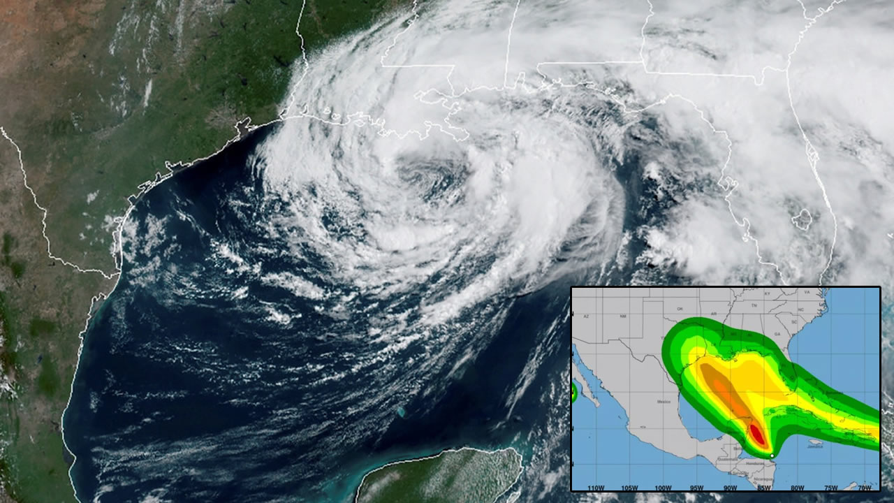
The Gulf of mexico could be hit by double hurricane. Never before had a similar phenomenon occurred there.
Next week, for the first time in recorded history, two hurricanes could hit the Gulf of Mexico at the same time. Twice before, in 1959 and 1933, two tropical storms entered the Gulf at the same time. But they never became hurricanes before.
So far this is a forecast, however one of the storm systems has strengthened to become tropical storm- a dangerous cyclone, but not a hurricane yet. The other is still one Tropical depression and its future is still unclear. But forecasting models have suggested the possibility since at least Thursday (Aug 20), and the storms are still on the path that would lead to double hurricanes in the Gulf.

Storm warnings
He National Hurricane Center (NHC) has issued tropical storm warnings across much of the Caribbean for Tropical Storm Laura, which reached tropical storm strength on August 21, meaning it has wind speeds between 63 and 118 km / h.
It is currently east of Puerto Rico and the first forecast clues show that it rotates over that US territory, the US Virgin Islands, Haiti, the Dominican Republic, Cuba, Florida and then towards the Gulf during the weekend and early next week.
Tropical Depression 14, which is expected to take the name Marco (if it becomes a tropical storm), is moving more slowly. Forecast tracks show that it is heading north from its current location near Honduras, directly into the Gulf. The NHC has issued tropical storm watches for parts of Honduras and southeastern Mexico, and a hurricane watch for much of eastern Mexico.

Initial forecast maps of the interacting winds from the two storms show that they overlap in the Gulf. And meteorologists have said that it is still too early to predict exactly how the two storms will behave, particularly if they begin to interact strongly.
One possibility is a significant ‘Fujiwhara effect’. According to the NHC, that’s a term meteorologists use for when two tropical cyclones approach and begin to “dance around their common center.”
It is unclear at this point how that would affect the movements of the storms in the Gulf, although The Washington Post informs that one possibility is a delayed arrival from Marco, giving him more time to fortify himself over the hot water.
The National Oceanic and Atmospheric Administration says that as the climate change warms the oceans, strong hurricanes are likely to become more frequent than in previous years.
Source | livescience / the washington post