


The ocean swallowed twenty-seven million square kilometers of land.
Between approximately 14,000 and 7,000 years before the present, as the last glacial maximum ended and the ice sheets that had locked a significant fraction of the Earth’s water supply in continental glaciers melted and returned to the sea, global sea levels rose by approximately 120 meters. The process was not uniform. It proceeded in pulses, with periods of rapid rise punctuating longer intervals of relative stability. At its most rapid, sea levels climbed several meters per century. The coastlines of the world retreated inland by hundreds of kilometers. The shallow continental shelves that had been dry land, inhabited and traversed by human populations for tens of thousands of years, disappeared beneath the advancing ocean.
The total area submerged in this period exceeds the combined landmass of present-day Africa. Every coastal civilization, every low-lying settlement, every culture that built its life on what is now the shallow seafloor of the world’s continental margins, was displaced or destroyed. The physical remains of those civilizations, their buildings, their middens, their cemeteries, their agricultural terraces, sit under water at depths that make systematic archaeological investigation technically challenging and economically unattractive.
The geological record of this submersion is not disputed. The question that the geological record leaves open is what was on the land before the ocean took it.
The Scientist Who Named Lemuria
Philip Sclater was not a mystic. He was a Fellow of the Royal Society, secretary of the Zoological Society of London, and one of the leading systematic zoologists of the Victorian period. When he proposed the existence of a land connection between Madagascar and India in 1864, he was solving a specific scientific problem using the standard methodology of nineteenth-century biogeography.
The problem was lemurs. Their fossil record appeared on both sides of the Indian Ocean in distributions that no known oceanic dispersal mechanism could explain. The same species, or closely related species, on opposite sides of a body of water too deep and too wide for any natural rafting or island-hopping route to account for. The standard scientific response to this class of biogeographical discontinuity was to propose a former land connection between the regions. Sclater proposed one, named it Lemuria after the animals whose distribution it would explain, and published the hypothesis in the Quarterly Journal of Science.
Ernst Haeckel, the German biologist who did more than anyone to popularize Darwin’s theory of evolution, adopted Lemuria enthusiastically and went further, proposing that the submerged continent was the cradle of humanity, the region where the human species evolved before dispersing across the Old World. Thomas Huxley, Darwin’s most prominent defender and one of the most rigorous scientific minds of the Victorian period, considered the Lemuria hypothesis scientifically plausible.
The hypothesis was superseded by continental drift theory rather than refuted by it. Alfred Wegener’s 1912 proposal, established as the foundational framework of modern geology by mid-century, confirmed that the land connection between Madagascar and India had existed, as part of Gondwana, approximately one hundred and fifty million years ago. The connection was real. Its timing simply predated the evolution of lemurs by a substantial margin, making it unable to explain their distribution by direct land crossing.
Alfred Wegener, whose 1912 continental drift theory provided the mechanism that made the Gondwana land connection comprehensible in modern geological terms, specifically named the process of the Hindustan and Madagascar plate separation the Lemurian compression, preserving Sclater’s nomenclature in the mainstream geological record even as the hypothesis it was coined to explain was superseded.

The biogeographical problem Sclater identified was real. His solution was wrong in its timing. The land he proposed had existed, in a different configuration, before mammals evolved. What existed in the Indian Ocean region during the period of human prehistory is a separate question that the continental drift framework does not close.
Sundaland and the Drowned World
The most scientifically credible version of the lost Pacific civilization argument requires no mystical framework and no esoteric sources. It requires only a map of the current ocean floor and the known sea level data from the post-glacial period.

During the last glacial maximum, approximately 20,000 years ago, sea levels were 120 meters lower than at present. The shallow seas of Southeast Asia, the Gulf of Thailand, the Java Sea, the South China Sea, and the Strait of Malacca, were dry land. The Indonesian islands of Sumatra, Java, Borneo, and Bali formed a single continuous landmass connected to mainland Southeast Asia. This landmass, known in the geological literature as Sundaland, covered approximately 1.8 million square kilometers at its maximum extent, roughly the size of India.
Sundaland was one of the most biologically productive regions on Earth, with a tropical climate, abundant water sources from the major river systems that drained the central plain, and coastal zones of extraordinary marine productivity. It was inhabited. The genetic and linguistic evidence for a major ancestral population center in this region is documented in the peer-reviewed literature. Stephen Oppenheimer’s analysis in Eden in the East, published in 1998, draws on mitochondrial DNA distribution patterns, linguistic phylogenies, and archaeological data to argue that Sundaland was a primary population center whose progressive submersion drove a series of dispersal events that populated the Pacific and influenced the development of civilizations from India to the Americas.
The submersion of Sundaland was not a single catastrophic event. It was a progressive process punctuated by rapid pulses. Meltwater Pulse 1A, approximately 14,600 years ago, raised sea levels by approximately twenty meters in less than five hundred years, an average of four centimeters per year that would have displaced millions of people from coastal and low-lying regions. The oral traditions of the Pacific Rim are saturated with accounts of great floods and sunken homelands. The Maori Hawaiki, the Samoan Bolutu, the Easter Island tradition of Hiva, the Hawaiian account of a sunken homeland, all describe a large landmass beneath the present ocean in the general Pacific region from which their ancestors fled. These traditions are in the documented ethnographic record. They predate any contact with the Atlantis tradition that could have introduced the concept from European sources.
The genetic record shows that the dispersal from the Sundaland region occurred in pulses consistent with the sea level rise events. The people who built the subsequent Pacific civilizations came from somewhere. The most parsimonious explanation is that they came from somewhere that is now underwater.
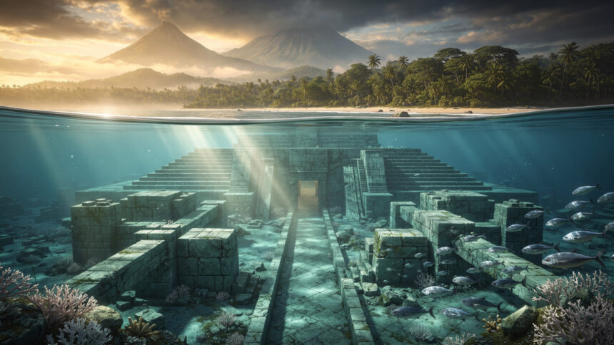
The Structure at Yonaguni
In 1987 a sport diver named Kihachiro Aratake discovered a large underwater formation near Yonaguni island in the Ryukyu chain of southern Japan. The structure sits at a depth of between five and twenty-seven meters. Its main feature is a stepped pyramidal form approximately 150 meters long and 40 meters wide with terraced faces, right-angle geometry at specific corners, and carved channels and what appear to be staircases cut into the rock.
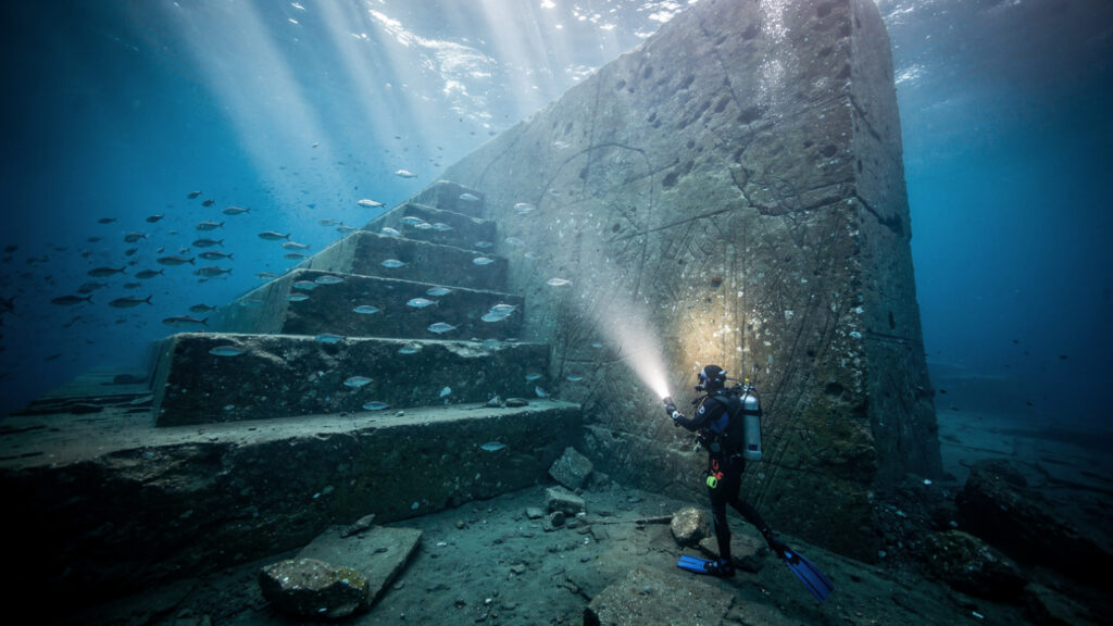
Masaaki Kimura, a marine geologist at the University of the Ryukyus, conducted formal analysis of the structure over more than a decade and published his conclusion that the main features are too geometrically regular and too specifically arranged to be products of natural erosion processes. The right-angle geometry in particular, he argued, does not occur in natural sandstone formations at this scale. His analysis identified what he interpreted as carved channels, a round hole whose interior shows tool marks inconsistent with natural formation, and structural arrangements suggesting a planned architectural design.
Robert Schoch of Boston University, a geologist whose work on the age of the Sphinx based on water erosion patterns established his credibility in alternative archaeology, examined the Yonaguni structure and initially agreed with Kimura’s artificial origin conclusion before revising his position. In his revised analysis, Schoch concluded that the main terraced features are consistent with natural fracturing of the sandstone along horizontal bedding planes, but acknowledged that specific elements of the structure remain difficult to explain through purely natural processes.
The depth at which the structure sits is consistent with submersion during the post-glacial sea level rise. If the structure was above water during the last glacial maximum, it would have been accessible to human populations approximately 10,000 to 14,000 years ago, a period well within the timeframe of anatomically modern human activity. The controversy over its origin has not been resolved. The structure has not been formally excavated. The Japanese government’s position on its status, natural geological formation, has not been supported by a systematic archaeological assessment.
Nan Madol and the Pacific Engineering Problem
Nan Madol sits in a lagoon off the eastern shore of Pohnpei in the Federated States of Micronesia. It is a city built on artificial islands, ninety-two of them, connected by canals, constructed from basalt logs of which the largest individual pieces weigh approximately fifty tons.
The basalt columns used in Nan Madol’s construction were transported from quarries on the opposite side of Pohnpei, across open ocean. The transport mechanism has not been established by any archaeological study. No boat design from the construction period has been identified that would permit the transport of fifty-ton basalt columns across open water. The local tradition attributes the construction to twin sorcerers named Olisihpa and Olosohpa, who used magic to fly the stones into position. The archaeological record shows the stones were moved. The method by which they were moved has not been explained.
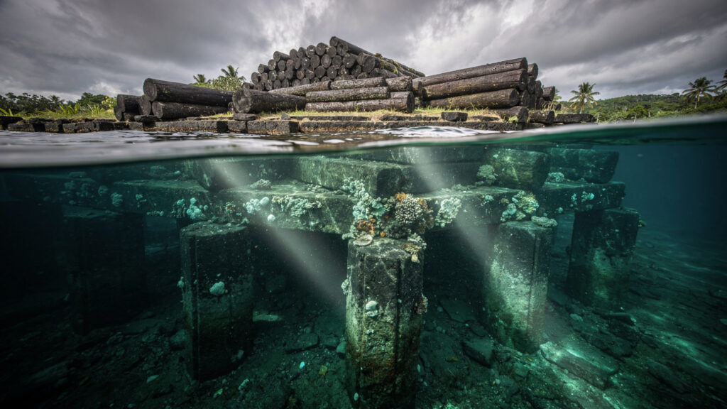
The visible surface structures of Nan Madol date to approximately 1200 CE and later. The underwater platform on which they are built extends to depths below the current waterline, suggesting construction phases that predate the surface structures by a period that could place their origin in the post-glacial submersion timeframe. The underwater portions of Nan Madol have not been systematically surveyed.
Nan Madol is not a fringe claim. It is a confirmed archaeological site listed on UNESCO’s World Heritage registry. The engineering problem it presents is not disputed. The solution to the engineering problem has not been published.
What Churchward Found and What He Made of It
James Churchward was a British colonel stationed in India in the late nineteenth century who claimed to have been shown ancient clay tablets by a Hindu priest that described the history of a civilization predating any known culture. His subsequent publications, beginning with The Lost Continent of Mu in 1926, built an elaborate reconstruction of a Pacific civilization that he called Mu, attributing to it the origin of all world religions, all major civilizational developments, and the dispersal of the human species across the globe.
Churchward’s specific claims about the Naacal tablets have never been independently verified. The tablets have not been produced in any accessible form. His translations cannot be cross-checked against primary sources. These are legitimate objections that the research literature has documented without resolution.
What is not a legitimate objection is the dismissal of the geographic and civilizational framework he was trying to describe, on the grounds that the specific documents he cited cannot be verified. The post-glacial submersion of massive areas of Pacific coastal land is confirmed. The distribution of similar megalithic construction techniques, similar symbolic systems, and similar origin traditions across the Pacific in cultures with no documented historical contact is confirmed. The biogeographic problem that led Sclater to propose Lemuria was genuine even if his solution was geologically mistimed.

Churchward was attempting to account for a pattern of evidence that the conventional archaeological framework of his time could not explain. His specific mechanism, the Naacal tablets and the Mu civilization, may not survive scrutiny. The pattern of evidence he was responding to has not gone away.
The Okanogan Salish people of the Pacific Northwest preserved a tradition documented in the early twentieth century by ethnographer James Teit: a large land in the center of the ocean, called Samah Tumi Whoolah, governed by a powerful female ruler, whose population degenerated and whose land sank progressively into the sea. Survivors traveled east across the ocean until they reached the American coast, their skin altered by prolonged sun exposure. The tradition was recorded by a trained ethnographer from a population with no access to the Atlantis tradition or to the nineteenth-century Lemuria literature. It describes the same event from the other shore.
The Shape of What Is Missing
The world’s major river systems flow toward the continental shelves and then off their edges into deep water. The fertile plains that human populations have always preferred for settlement are concentrated in exactly those coastal and low-lying regions that the post-glacial sea level rise covered. The agricultural revolution, the development of writing, the construction of the first cities, all occurred in the narrow window between the end of the most rapid sea level rise, approximately 7,000 years ago, and the current period.

What was occurring in the immediately preceding period, in the Sundaland basin, in the Indian Ocean coastal regions, in the Pacific continental shelves, is accessible only through the underwater archaeological record that has not been systematically surveyed, through the genetic and linguistic traces that dispersal populations carried with them, and through the oral traditions that the displaced populations maintained across the subsequent millennia.
The traditions are consistent. A great land, in the ocean, governed by a sophisticated civilization, sank. The survivors dispersed and carried the memory of the homeland with them. The memory was maintained in four separate Pacific cultures whose traditions were recorded by ethnographers before any significant Western influence could have introduced the Atlantis narrative. The traditions describe the same event from different vantage points.
The geological record confirms the submersion. The genetic record confirms the dispersal. The linguistic record confirms the common ancestry of Pacific populations from a source region that is now underwater. The archaeological record has not been gathered from the seafloor in any systematic way.
Lemuria and Mu as Churchward and Blavatsky described them are reconstructions that exceed the available evidence. Sundaland as the geological record and the genetic studies describe it is confirmed. The question is not whether there was a large inhabited landmass in the Pacific and Indian Ocean regions that the ocean progressively covered. There was. The question is what its civilization had achieved before the water came.
Easter Island’s traditions say Hiva sank. The Maori say they came from Hawaiki, beneath the sea. The Okanogan say their ancestors watched their homeland disappear behind them as they paddled east. Four separate peoples on four separate shores of the same ocean remembering the same event.
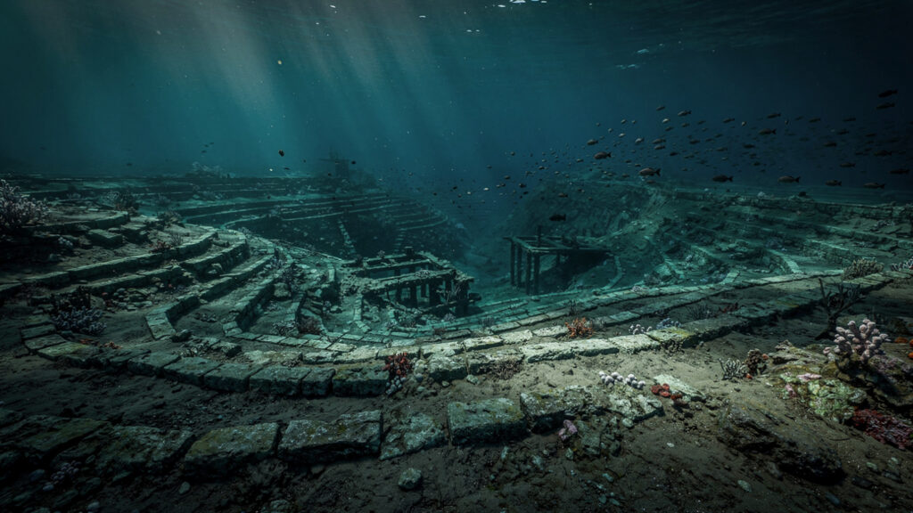
The ocean is there. The floor is documented. The structures are sitting in the shallow water where the sea level stopped rising.
What is waiting on that floor is the question that the geological confirmation of the submersion makes impossible to dismiss and the absence of systematic survey makes impossible to answer.