


No climbing permit has ever been issued for Mount Kailash.
Not because the ascent is technically impossible. The peak reaches 6,638 meters, a serious but achievable altitude that dozens of neighboring Himalayan summits have surrendered to documented climbs. Not because the Chinese government, which has administered Tibet since 1950 and manages Kailash as a regulated pilgrimage destination generating substantial annual revenue, lacks the administrative infrastructure to process the application. The stated rationale is religious sensitivity. The pilgrimage traditions of Hinduism, Buddhism, Jainism, and the ancient Bon shamanic framework all identify Kailash as sacred ground whose summit should not be trodden by human feet.
Religious sensitivity is a legitimate consideration. It is also the only category of rationale that forecloses the question the mountain’s geometry raises for anyone who examines it without the framework of the pilgrimage tradition.
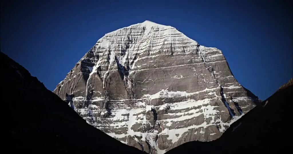
The mountain has four faces. Each face orients within measurable tolerance of a true cardinal direction. North. South. East. West. The slope angles of those four faces approximate the angles of the Great Pyramid of Giza within the margin of error available from ground-level measurement without summit access. The surrounding Himalayan massif presents the chaotic, asymmetric fracture geometry that tectonic uplift produces in granite. Kailash presents a four-sided pyramidal form whose cardinal orientation would require, if produced by natural geological processes, a coincidence of tectonic forces that geologists have not formally modeled because the modeling has not been attempted at this site.
The Chinese government has never issued a permit. Aerial survey of the summit region has been restricted beyond what pilgrimage management requires. The Soviet geological surveys conducted in the region during the 1960s and 1970s produced classified findings whose content has not been released.
Three separate institutional actors have independently decided that categories of investigation of this mountain should not proceed. The convergence of those decisions is its own data point.
The Axis
Four independent religious traditions converging on a single geographic coordinate is not a phenomenon that statistical probability distributes casually across a mountain range containing thousands of peaks.
Hinduism identifies Kailash as Mount Meru, the axis of the world, the cosmic mountain at the center of the universe around which the planetary architecture organizes. The Shiva tradition places the deity’s permanent residence at the summit. The mountain is not a site where the sacred is commemorated. It is a site where the sacred is actively present.
Buddhism identifies Kailash as the residence of Demchog, the deity of supreme bliss, and as the earthly manifestation of the pure realm that advanced practitioners aim to reach through lifetimes of practice. The Tibetan tradition places the mountain at the center of the mandala that describes the structure of enlightened reality.
Jainism identifies Kailash as Ashtapada, the site where Rishabhanatha, the first of the twenty-four Tirthankaras, attained liberation from the cycle of rebirth. The liberation event, in Jain cosmology, establishes a permanent energetic imprint at the geographic location where it occurred.
The Bon tradition, which predates the arrival of Buddhism in Tibet by centuries and represents the oldest surviving shamanic framework in the Himalayan region, identifies Kailash as the seat of all spiritual power in the world. The Bon practitioner Milarepa is recorded as having arrived at Kailash to contest its spiritual authority with a Bon master and having won the contest through a display of power at the summit. The story encodes a historical moment of religious transition while preserving the older tradition’s identification of the site.
Four traditions. Four separate theological frameworks developed across different centuries by populations with no coordinating institution. Each identifying the same mountain as the most significant geographic point in its cosmological map.
The standard explanation is that the mountain’s dramatic visual presence in the landscape, its isolation on the Tibetan plateau, and its proximity to the headwaters of four of Asia’s major rivers, the Indus, the Ganges, the Sutlej, and the Brahmaputra, made it a natural focus for sacred attribution. This explanation requires the four traditions to have independently generated identical cosmological identifications from visual and hydrological impressions. It does not explain why no other peak in the Himalayan range, including peaks of greater height and equal dramatic presence, produced the same convergence.
Something to this location, not its appearance and not its hydrology, drew four independent cosmological frameworks to the same coordinate.
What Ernst Muldashev Found
Ernst Muldashev is a Russian ophthalmologist whose primary professional reputation rests on corneal transplantation research. He led a series of expeditions to the Kailash region in the 1990s under the sponsorship of Russian geographical and scientific institutions. His findings, published in multiple volumes and received by the Russian scientific establishment with the silence reserved for research that cannot be dismissed on methodological grounds and cannot be accommodated within the existing framework, constitute the most documented investigation of the Kailash anomaly available in the public record.
Muldashev measured. The four-face cardinal orientation he confirmed within one degree of true north, south, east, and west. The slope geometry he documented in comparative relationship to the proportions of the Great Pyramid and other documented ancient pyramidal structures. The comparison produced correspondences that the natural geological formation thesis cannot accommodate without proposing a mechanism by which tectonic forces produced pyramidal geometry matching ancient architectural standards.
His expeditions documented temporal anomalies reported by multiple team members independently. Accelerated hair and nail growth in the vicinity of the peak, at rates inconsistent with the metabolic effects of altitude and cold. Compass deviation patterns that did not correspond to the known magnetic anomaly profile of the region. Psychological effects including acute temporal disorientation, the subjective experience of time passing at rates inconsistent with elapsed clock time, reported by expedition members without prior discussion of the possibility.
Muldashev’s interpretation of these anomalies placed Kailash within a global network of sites he identified as functioning components of a planetary information and energy system installed in the deep geological past. His claim, that the mountain contains subsurface structures whose geometry does not correspond to natural rock formation, has not been formally tested by any institution with the ground-penetrating radar capability to produce a definitive answer, because the access required for that testing has not been granted.
The Russian government classified the Soviet-era geological surveys of the region. Muldashev’s post-Soviet research was conducted with institutional support that subsequently became unavailable. His published findings sit in the public record. The investigation his findings call for has not been conducted.
The Radioactive Question
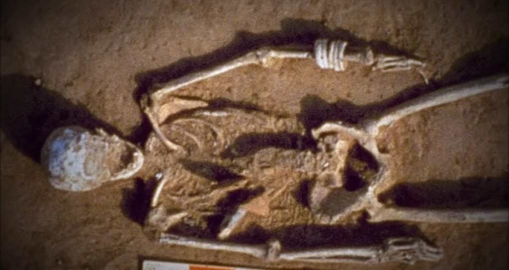
The claim that biological remains recovered from the high-altitude fissures of Kailash exhibit elevated levels of radio-isotopes has been in circulation in the alternative research community long enough to have produced a body of secondary commentary without producing a body of primary laboratory analysis available for independent review.
This is the pattern that distinguishes a claim requiring investigation from a claim that has been investigated and found wanting. The radioactive anomaly at Kailash has not been formally tested by any institution with the relevant instrumentation and the access to the site. The absence of formal testing in a region administered by a government with full geological survey capability, applied to a testable claim that has been in the public research record for decades, is the kind of institutional gap that warrants examination rather than dismissal.
The parallel from another ancient site is documented and not in dispute. Mohenjo-Daro, the Indus Valley civilization city dated to approximately 2500 BCE, contains a stratum of vitrified material at a archaeological layer whose production requires temperatures exceeding those achievable by the wood and charcoal combustion available to the city’s documented inhabitants. The vitrification pattern and isotopic signature of the Mohenjo-Daro glass have been documented by researchers including David Davenport and Ettore Vincenti, whose analysis was published in the journal East and West in 1979. The claim that the vitrification pattern is consistent with a nuclear or thermite event rather than conventional fire has not been formally refuted. It has been ignored.
A radioactive anomaly at Kailash and a vitrification event at Mohenjo-Daro, two sites in the same broad geographic region, both attributed to the same pre-modern period, both generating institutional silence rather than formal investigation, constitute a pattern whose significance is not diminished by the absence of the formal investigation that would resolve it.
The Global Grid
Christopher Dunn published The Giza Power Plant in 1998. His engineering analysis of the Great Pyramid, approached from the perspective of a manufacturing engineer rather than an archaeologist, produced claims about the acoustic and electromagnetic properties of the structure’s interior that the field of Egyptology has not formally engaged with in the quarter century since publication. Dunn’s central thesis, that the King’s Chamber functions as a coupled oscillator designed to convert the Earth’s natural seismic vibrations into directed electromagnetic energy, requires either a formal technical refutation or a formal acknowledgment that the engineering specifications he documents are inconsistent with the funerary monument hypothesis.
Neither has been produced.
The connection between Dunn’s Giza thesis and the Kailash geometry is the global grid framework developed by researchers including Bruce Cathie and Ivan T. Sanderson, whose twelve-point electromagnetic vortex map places both Kailash and Giza within the same planetary energy architecture. Angkor Wat in Cambodia, whose temple complex is oriented with astronomical precision that the construction period’s documented technology barely explains, sits at a angular relationship to Giza that the grid framework accounts for as a designed correspondence. Puma Punku in Bolivia, whose H-shaped stone blocks are machined to tolerances requiring either advanced tool technology or a construction method not present in the official account of pre-Columbian Bolivia, occupies a third grid coordinate.
The thesis requires accepting that a planetary-scale engineering project was executed by an intelligence with complete geodetic knowledge of the Earth’s surface, the ability to quarry, transport, and construct at scales requiring energy sources not identified in the conventional archaeological record, and the motivation to distribute the resulting installations at geometric coordinates across every inhabited continent.
The motivation question is the one the source material handles least satisfactorily. The monkeyandelf standard does not require an answer to every question the evidence raises. It requires identifying the question clearly.
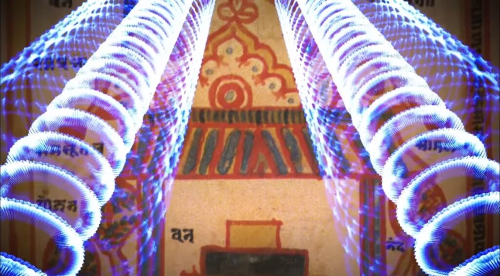
The Sumerian texts identify the Anunnaki as requiring gold for physiological reasons documented in the previous piece. The Sanskrit texts that describe celestial beings converging on Kailash identify a different requirement: proximity to the radiation field emanating from the mountain’s core, described as an energetic refueling source for physiological systems operating under conditions the Earth’s surface presented as hostile to their biology.
Two separate ancient textual traditions describing non-human physiological requirements that geographic installations addressed. The installations correspond to sites whose geometry, construction precision, and radioactive or electromagnetic anomalies are documented in the physical record. The textual descriptions and the physical evidence are pointing at each other across five thousand years.
The Summit That Cannot Be Reached
The Chinese government’s policy on Kailash climbing permits has remained consistent since 1950. The stated rationale, religious sensitivity, applies equally to dozens of peaks across the Himalayan range that have been opened to climbing under managed permit systems. Kailash specifically has never received that management framework.
In 2001 the Chinese government briefly indicated that a Spanish climbing team would be permitted to attempt the summit. The announcement generated immediate protest from Hindu, Buddhist, Jain, and Bon religious organizations across India and Nepal. The permit was rescinded. The Chinese government has not revisited the question publicly since.
The religious protest is documented and genuine. The convergence of four traditions in opposition to summit access is consistent with the same convergence that identifies the site as cosmologically significant. What the protest does not explain is why aerial survey and ground-penetrating radar assessment of the summit region, operations that do not involve physical presence on sacred ground, have also not been conducted or published by the institutions that have administered the region for seventy-five years.
A geological survey of a mountain does not require climbing it. The technology exists. The institution administering the region possesses it. The survey has not been published.
The Soviet surveys were classified. The Chinese surveys, if conducted, have not been released. Muldashev’s independent measurements documented anomalies requiring follow-up investigation that has not been authorized.
The mountain sits at the center of four cosmological maps. Its geometry is pyramidal and cardinally oriented in a mountain range that produces nothing else resembling it. Its summit region has not been formally surveyed by any institution willing to publish the results.
Whatever the summit region contains has been protected by four separate institutional decisions across three different governments over more than half a century.
The geometry visible from the ground is precise enough to raise the question. The geometry of the decisions to prevent closer examination is equally precise.
Both point in the same direction.